

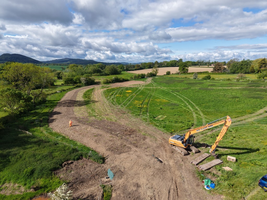
A stretch of agricultural land near Lea, southwest Shropshire, was experiencing repeated flooding from surface water runoff and high flows from the nearby Rea Brook. Flood water regularly overtopped the adjacent country road, restricting access to livestock during significant rainfall events.
RAB worked with the client Severn Rivers Trust, the appointed contractors WM Longreach and the landowner to investigate the causes of flooding and develop a practical, long-term solution. Using on-site investigations, LiDAR data, hydraulic modelling and an options appraisal, the team designed an integrated natural flood management (NFM) scheme that slows, stores and controls floodwater while maintaining agricultural access and reducing pressure on existing drainage infrastructure.
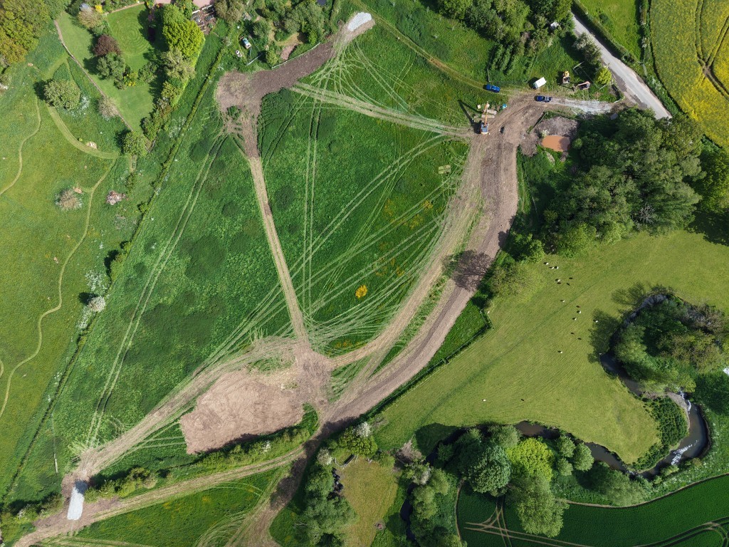
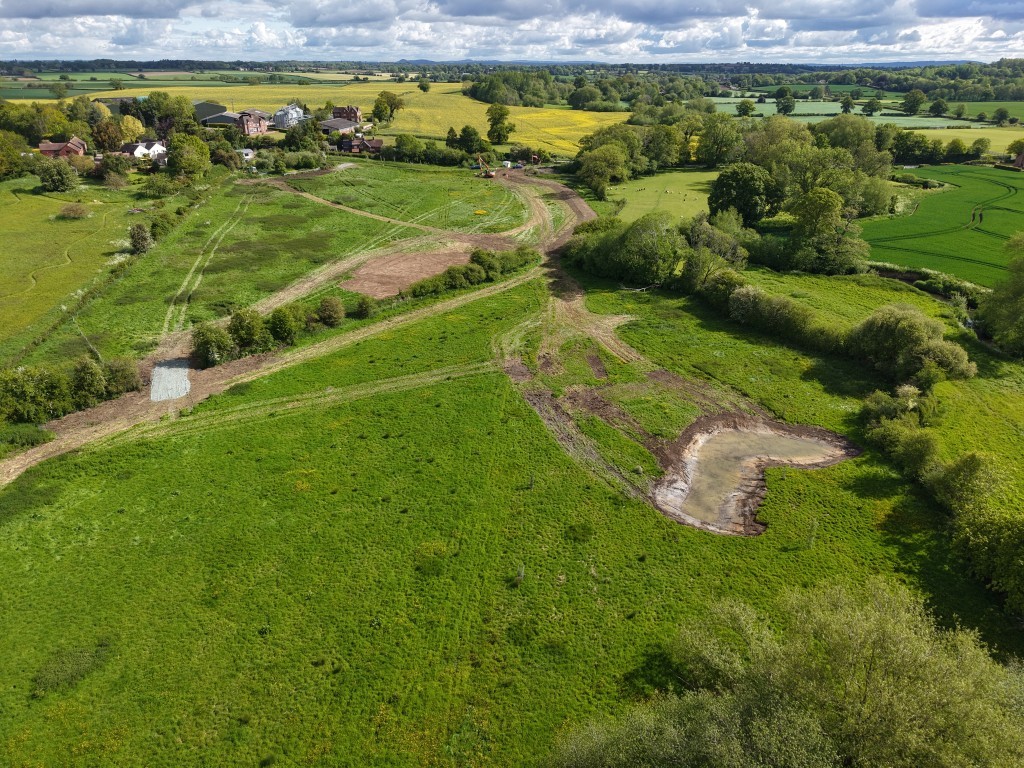
The completed design combines flood storage scrapes, an earth bund, a controlled outfall and a new agricultural bridge, working with the site’s existing topography to reduce flood risk.
Importantly, the scheme is not intended to entirely prevent all flooding events, but help to improve the site’s resilience during significant rainfall events while maintaining its agricultural function.
What was Causing the Flooding?
During significant rainfall events, surface water naturally collected within low-lying areas of the undulating livestock field. As runoff increased, the existing drainage ditch and downstream culverts became overwhelmed.
At the same time, high flows within the nearby Rea Brook contributed to the wider flood risk. The resulting floodwater could overtop the country road, cutting off access to Oak House.
For the landowner, maintaining reliable access was a major concern. The repeated flood events demonstrated the need for a solution that could manage water within the site rather than simply increasing the capacity of existing drainage infrastructure.
Understanding the Site and Flood Risk
We undertook a detailed investigation to establish how water moved across the site and to determine the most effective approach to reducing flood risk.
The investigation included:
- Site inspections and assessments.
- Review of historic flood information.
- Analysis of aerial imagery.
- LiDAR terrain data assessment.
- Hydraulic modelling of existing flow routes.
- Assessment of potential flood mitigation measures.
- An options appraisal to compare alternative solutions.
The hydraulic modelling was used to understand how the site responded during different flood events and to test the performance of potential interventions.
What flood management options were considered?
The options appraisal considered a range of measures, including:
- Increasing the capacity of the existing drainage ditch.
- Creating dedicated flood storage scrapes.
- Constructing an earth bund to intercept and control surface water.
- Combining multiple interventions into an integrated flood management scheme.
The modelling demonstrated that a combined approach provided the most effective solution. Rather than relying on a single drainage intervention, the scheme could utilise the site’s natural topography to temporarily store water, slow its movement and control its release.
Engineering the Natural Flood Management Solution
The final design comprises several complementary features designed to work together.
Flood Storage Scrapes
A series of flood storage scrapes were positioned within existing low-lying areas where water already naturally ponds. During heavy rainfall, these scrapes provide temporary storage, reducing the volume and rate of water moving through the downstream drainage system. The excavated material was also reused elsewhere within the scheme, providing material for construction of the earth bund.
Earth Bund
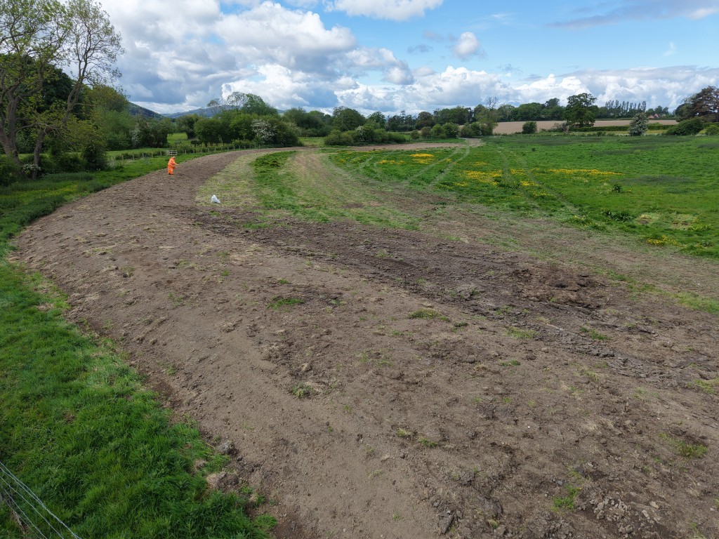
The earth bund forms the principal flood management feature.
Hydraulic modelling was used to establish the optimum bund alignment and crest level. The design enables the bund to intercept and temporarily retain significant volumes of surface water before directing flows safely towards the Rea Brook.
The bund was designed to work with the site’s natural contours rather than attempting to completely prevent water from entering the floodplain.
Controlled Outfall
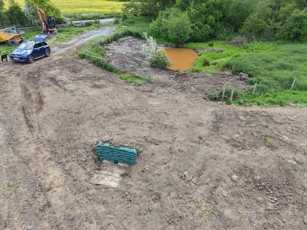
A controlled outlet pipe was incorporated through the bund to regulate the rate at which stored water is released.
The pipe was deliberately sized so that its discharge does not exceed the capacity of the downstream road culvert. This helps prevent the scheme from simply transferring flood risk downstream.
This controlled approach is central to the design: water is stored during peak rainfall, released at a controlled rate, and managed within the existing capacity of the downstream drainage system.
Agricultural Bridge
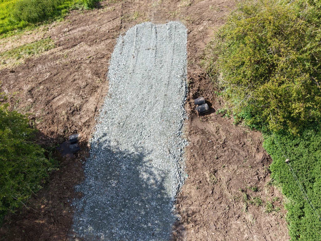
The scheme also required a new agricultural bridge to maintain access across the site.
Consultation with the landowner established that the crossing needed to accommodate agricultural machinery weighing up to approximately 18 tonnes. This requirement led to revisions to the bridge geometry, depth of pipe coverage and structural design.
The final design therefore provides both the required hydraulic performance and the durability needed for long-term agricultural use.
Overcoming Engineering and Environmental Challenges
The flood risk was only one of the engineering challenges associated with the project.
Gas Main
An intermediate gas main crossed the site, requiring careful coordination during design and construction planning.
Exclusion zones, updated utility information and CAT scanning were incorporated into the construction requirements to reduce the risk associated with excavation and earthworks near the existing service.
Floodplain Compensation and Earthworks
Floodplain compensation was an important consideration throughout the design.
Material excavated from the flood storage scrapes was reused to construct the bund. This approach helped balance earthworks across the site, reduce the requirement for imported material and maintain the required flood storage capacity.
The result was a more efficient and sustainable earthworks strategy.
Risk Management
We maintained a live project risk register throughout the design process, covering construction, environmental, hydraulic and operational risks.
Mitigation measures were developed alongside the design, with detailed specifications and construction guidance provided to support future contractors and reduce implementation risks.
What Was the Outcome?
The scheme provides a site-specific natural flood management solution designed to reduce flood risk while working with the existing landscape.
Rather than attempting to eliminate flooding altogether, the scheme manages water by:
- Intercepting surface water runoff.
- Temporarily storing floodwater in natural low points.
- Slowing the movement of water through the site.
- Controlling the rate at which stored water is released.
- Reducing pressure on downstream drainage infrastructure.
- Maintaining agricultural access across the site.
By combining hydraulic modelling with practical engineering design, RAB Consultants developed a solution that improves resilience while making effective use of the site’s natural characteristics.
The project demonstrates how natural flood management, hydraulic analysis and conventional engineering infrastructure can be combined to provide a practical and sustainable approach to rural flood risk reduction.
For any flood alleviation or nature-based solutions please get in touch with one of the team at enquiries@rabconsultants.co.uk or head to our submit a form here.